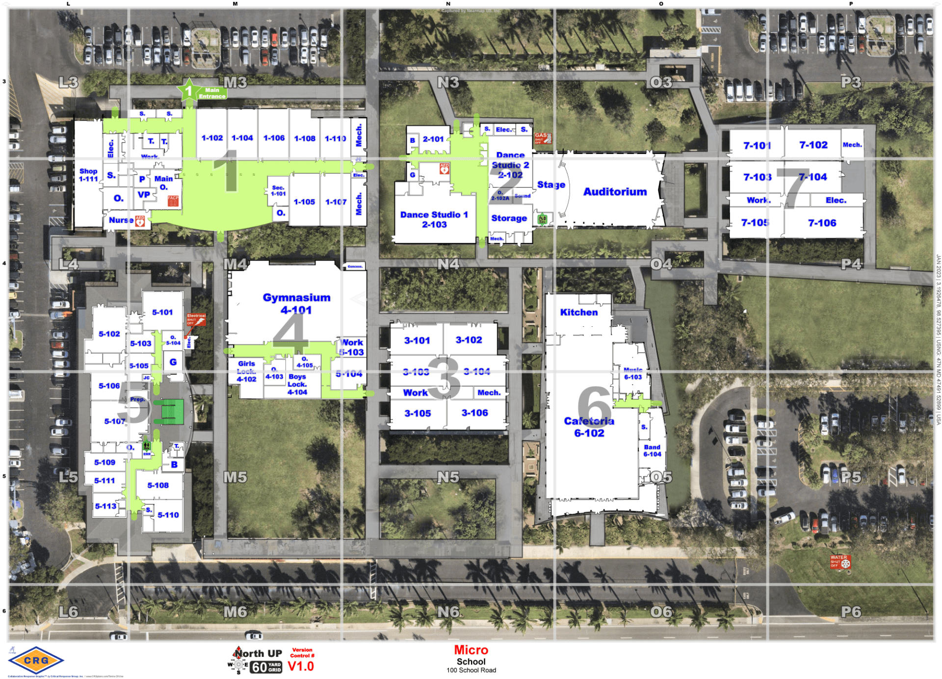
From large public universities to the smallest private elementary schools, the safety of our children is of the utmost importance. In a crisis where every second is critical, emergency response teams need clear, unified location data to coordinate and communicate quickly and decisively. This is the essence of critical incident mapping.

Location Types
Critical Incident Mapping™ for All School Types
Educational institutions of all sizes demand the same level of care and information in their relationship to first responders. Collaborative Response Graphics® (CRGs) are field tested emergency tools for all schools to communicate vital location data when accuracy and intelligence matter most.
Trusted By Industry Leaders
Critical Response Group is trusted by educational institutions across the country.


Works with CRG
Integrations
CRGs seamlessly integrates into the technology platforms educational institutions deploy and trust, which ensures that our maps are always there when needed.


”CRGs allow school officials to communicate easily with first responders during an emergency. A key feature of the product is that we were able to integrate it into our existing emergency platforms without the need for additional purchases.
-School District in Virginia
Using Common Language
CRGs ensure that teachers, security teams and emergency response units all have the same unified nomenclature such as “media center” versus “library”. This removes communication errors in a crisis.
Integrations Into Existing Tools
Our maps can be integrated with Raptor, Navigate360, CrisisGo, and other tools school districts and universities trust.
Location-Specific Plans
With common graphics, educational institutions and first responders are able to build more collaborative, intelligent action plans including reunification, emergency evacuation, and more.
Begin putting your action plan in place today.
Learn how your school can benefit from Collaborative Response Graphics®
