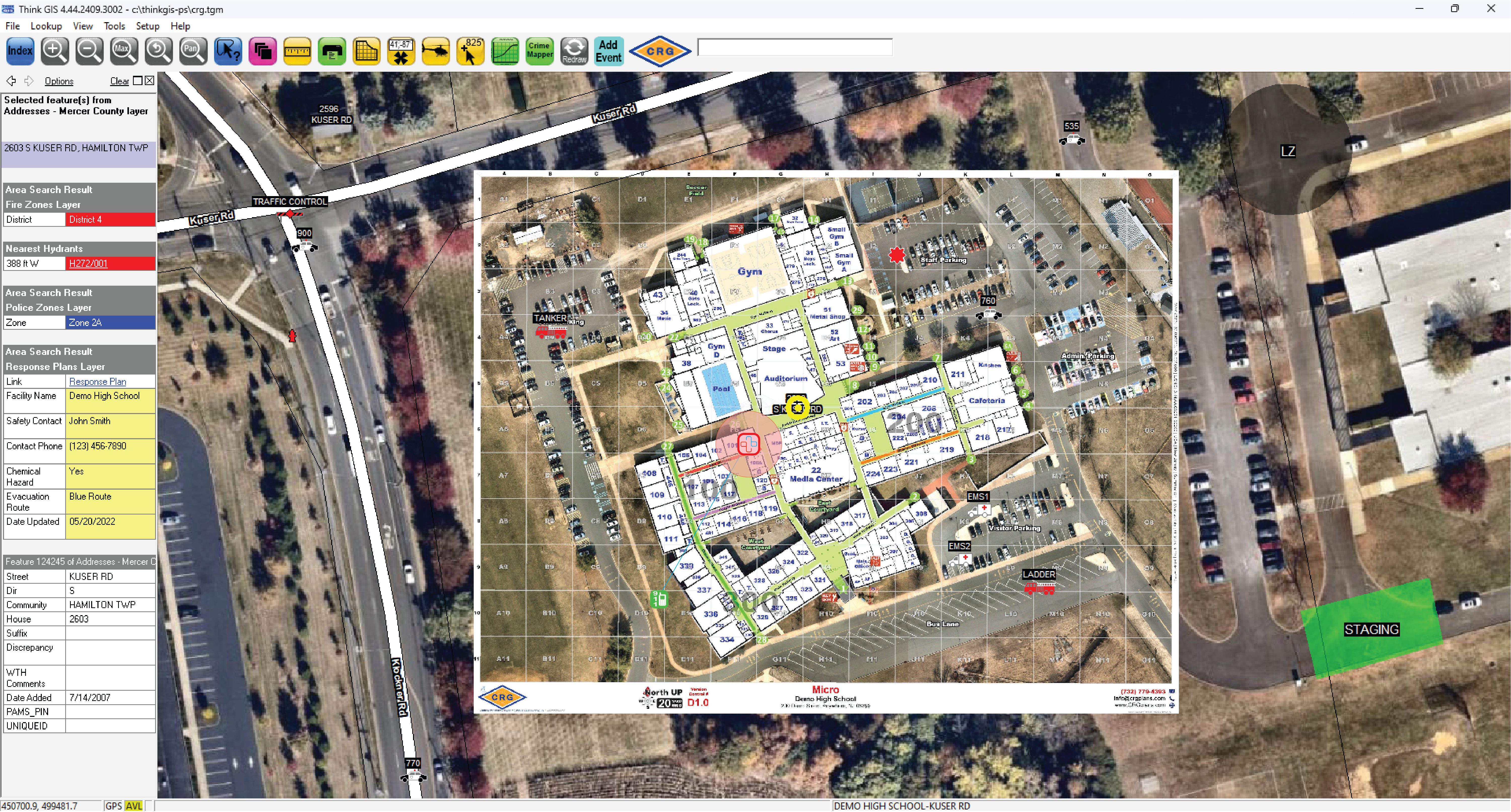

WTH Think GIS® integrates Collaborative Response Graphics® into its emergency mapping solutions, enhancing public safety and emergency response through advanced GIS technology.
Think GIS® is a powerful, accessible GIS software platform. Its robust set of tools provides the ability to create, maintain, view, query and analyze location-based information quickly and easily. It can integrate a variety of real time data sources into a single, logical map view providing high quality situational awareness.