Speakers

Joe Hanson
VP of Sales, CRG

Todd Komanetsky
VP of Partnership Strategy, RapidDeploy
Hosted by
Date
June 18th, 2025
Time
1:00 pm EST
Discover how CRG customers in Michigan can maximize their existing investment by integrating maps into a modern, cloud-native PSAP environment.
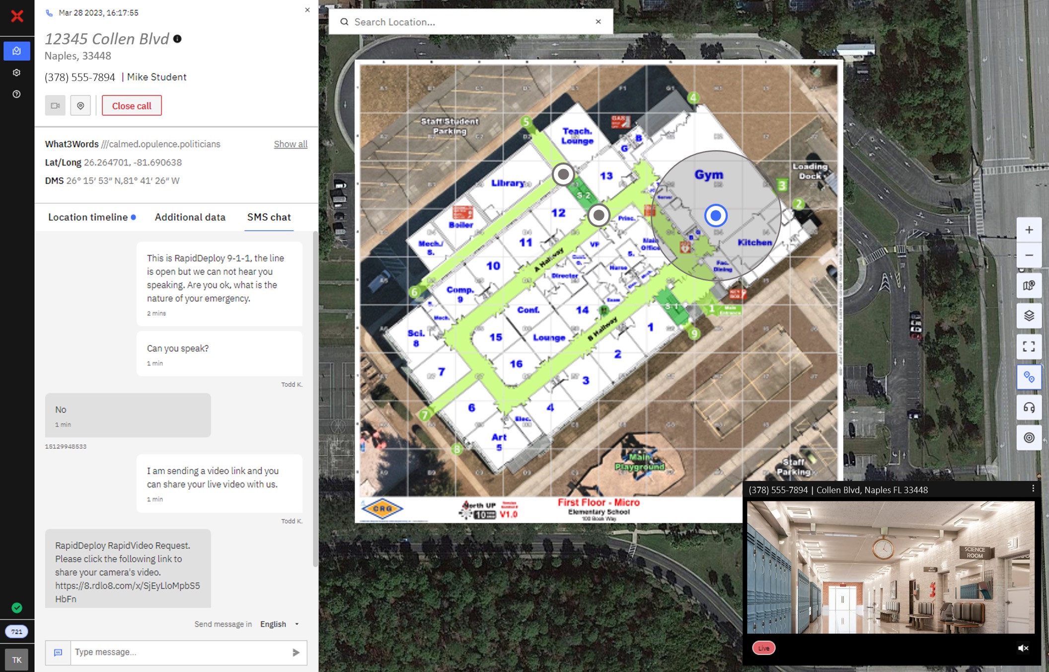
Thousands of schools and campuses across Michigan are already mapped with Collaborative Response Graphics®—giving public safety agencies access to accurate, validated floor plans. But having the right data is only the first step. This webinar will show how integrating CRG maps into RapidDeploy’s Radius Mapping platform transforms that data into real-time operational insight for 911 call takers, dispatchers, and first responders.
Hosted by RapidDeploy and Critical Response Group, this session will highlight how CRG maps integrate directly into the Radius platform and Lightning mobile app, enabling location-aware emergency response across agencies. By combining CRG’s detailed indoor mapping with Radius’s real-time 911 caller data, GIS overlays, and mobile deployment capabilities, your agency can improve situational awareness, speed of response, and interagency coordination when every second counts.
What You’ll Learn:
- How CRG maps integrate seamlessly into RapidDeploy’s Radius Mapping platform
- The benefits of viewing indoor floor plans alongside live 911 caller locations and GIS layers
- How the Lightning app delivers real-time mapping and 911 intelligence directly to first responders’ mobile devices
- Real-world examples of how agencies nationwide are enhancing school safety operations
- Steps to begin using your community’s CRG maps within the RapidDeploy ecosystem