RapidDeploy was acquired by Motorola Solutions in 2025, and is now part of its ecosystem of safety and security technologies.
RapidDeploy’s Next Generation 911 (NG911) product suite accelerates emergency response and enhances decision-making. With a curated partner network, our platform combines mobile signals, critical datasets, and call information into a single operating system, improving emergency response with location accuracy, situational awareness, modern communications, and actionable insights. Our products improve outcomes and ultimately help save lives.
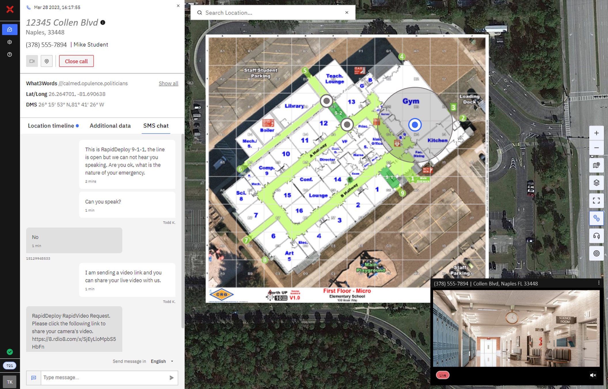
Powered by the cloud, Radius Mapping integrates floor plans into agency authoritative and commercially available GIS data and automatically plots the location of the 911 caller, giving call takers and agencies the situational awareness they need to route emergency services effectively and efficiently.
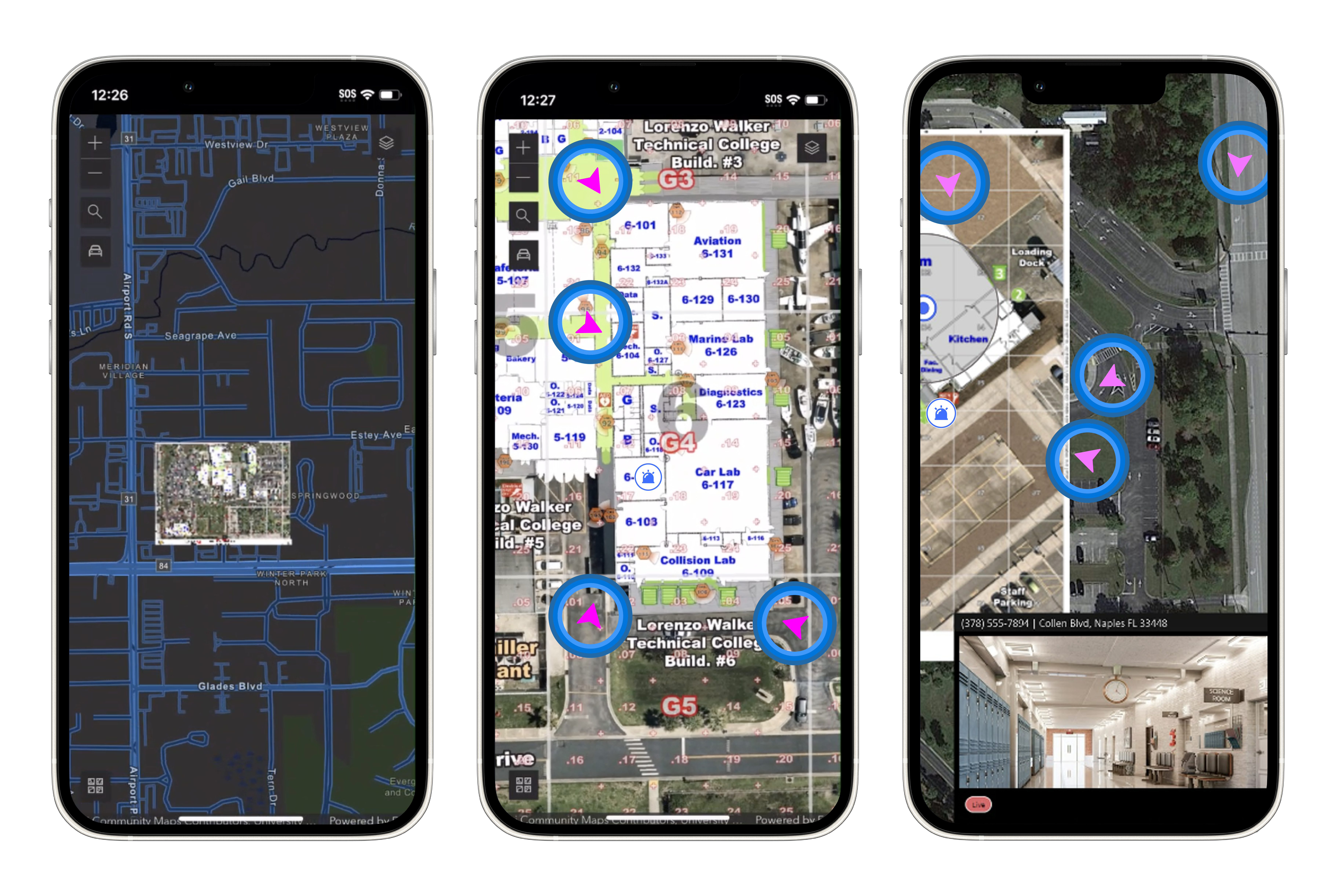
Lightning is a mobile application that delivers 911 data directly to first responders’ devices, including smartphones and tablets. Lightning is powered by Radius Mapping, extending critical information directly into the field, giving field responders immediate access to real-time 911 call data, video feeds, location accuracy and GIS mapping layers including base maps, indoor floor plans, and unique layers for each agency.