Know Where Your Team Is
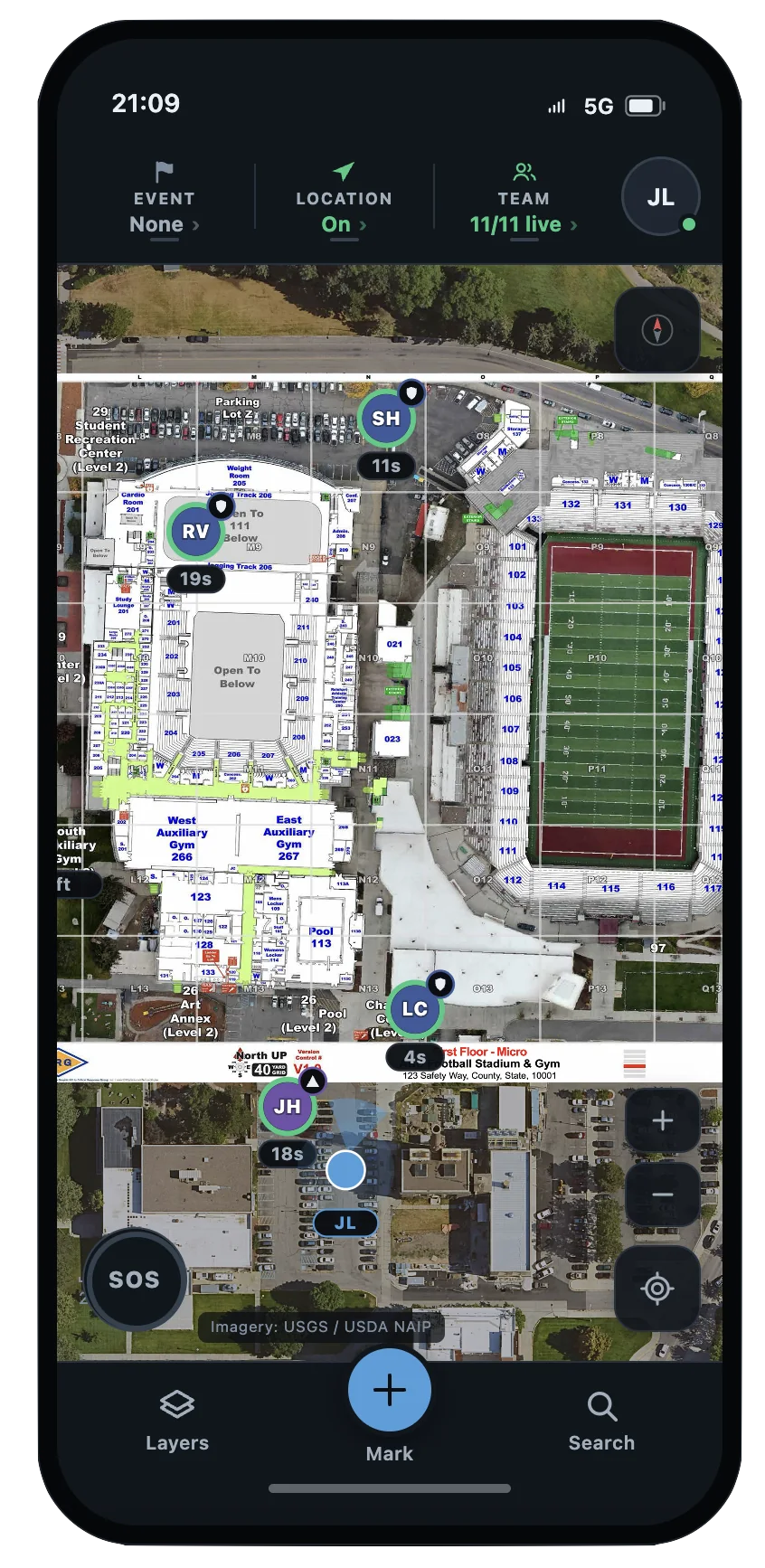
- View participating responders’ positions and direction of view on a shared map.
- Reach team members directly by chat or call — coordinate without adding unnecessary radio traffic.

Know where your team is, what is around them, and how the operation is moving — from the briefing to the all-clear.


Purpose-built for U.S. public safety, CRG OnScene™ combines real-time responder awareness, operational planning, and trusted mapping information in one shared operating picture. Teams in the field and at command see participating personnel and resources, coordinate around a common map, and adapt plans as conditions change.
Public-safety operations change quickly. Teams need more than a static map or a list of personnel locations. CRG OnScene™ connects the people, plans, and location information involved in an operation so participating teams keep a common understanding as it develops.
Position updates are flowing normally from this device.
Collaborative Response Graphics® began with a straightforward operational need: give responders a verified picture of the ground that they can use together under pressure. CRG OnScene™ advances that by showing where participating teams are and how the operation is changing — in addition to the environment.
Designed with experience from U.S. Special Operations Forces, tactical operators, engineers, and public-safety practitioners, OnScene is built around how teams plan, communicate, and make decisions in the field.
The same shared operating picture supports planned activity, fast-moving incidents, and operations that expand across teams or agencies.
Keep unit locations and relevant building or site context available as personnel respond to calls and coordinate with command.
Develop and brief plans for staging, perimeters, entry, and team positioning, then update markings and shared information as circumstances change.
Prepare the operational picture in advance, view participating personnel and resources during the event, and communicate changes as needed.
Give additional responding teams a shared reference for personnel, resources, and operational markings without requiring permanent access to each other’s organizations.
CRG OnScene™ supports mobile use in the field and web access at the command post. Responders and command personnel work from the same evolving view of participating teams, operational markings, and relevant location context.
Because OnScene works on standard basemaps, teams can use it wherever they operate.
Verified CRG indoor mapping adds another level of facility detail wherever that information exists.
CRG has built its approach around accurate mapping, shared geographic references, and direct feedback from public-safety professionals. CRG OnScene™ extends that work from verified maps into operational planning and real-time team awareness.
Our police department uses CRG OnScene™ to real-time track officers during special events and safety exercises. This enables us to better deploy resources, and manage the command and control of officer movements.— Chief of Police, New Jersey
Give participating teams a shared view of responders, resources, operational plans, and trusted location information — from a routine operation to a complex response. Speak with a CRG expert to see how CRG OnScene™ can support your agency.
CRG OnScene™ is a real-time situational awareness and operational mapping application designed for U.S. public safety. It combines responder location tracking, tactical planning, communication, and trusted mapping data into one shared operating picture for personnel in the field and at command.
No. CRG OnScene™ works with standard basemaps wherever teams operate. When Collaborative Response Graphics® are available, responders can also access verified indoor floor plans and detailed facility information within the same operating picture.
Yes. CRG OnScene™ provides real-time location awareness for participating responders, allowing authorized team members to view personnel positions and direction of view on a shared map. Location sharing is user-controlled.
Yes. CRG OnScene™ allows users to contact participating responders directly by chat or call. Teams can also share operational markings and planning updates in real time to help coordinate field and command personnel.
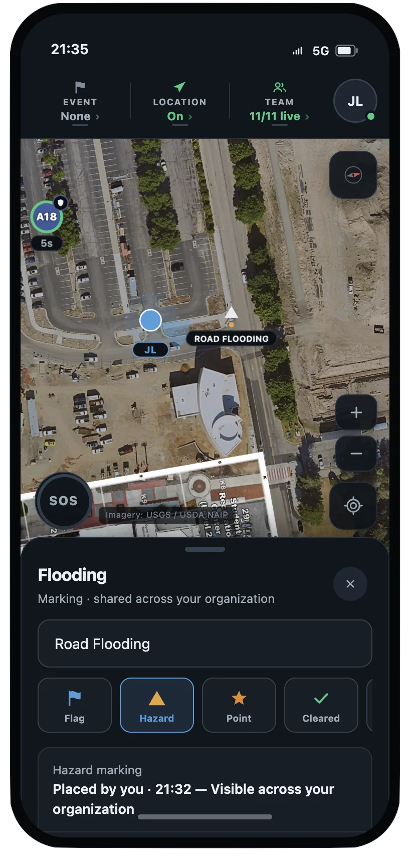
CRG OnScene™ allows teams to mark staging areas, perimeters, rally points, hazards, and cleared areas on a shared map. Users can add measurements and photos, develop operational plans, and distribute updates as conditions change.
Yes. CRG OnScene™ supports multi-agency coordination by allowing law enforcement, fire, EMS, and other mutual-aid partners to join a shared operation. Access is invitation-based, and participating agencies do not need to permanently share organizational information.
CRG OnScene™ is designed primarily for law enforcement agencies and tactical teams, including patrol officers, SWAT, and incident commanders. It also supports fire, EMS, emergency management, and mutual-aid personnel who need shared situational awareness during daily operations, planned events, and emergency response.
OnScene in Action
See OnScene™ in action
Speak with a CRG expert to see how CRG OnScene™ can support your agency.