One Common Operating Picture.
From Preparedness Through Response.
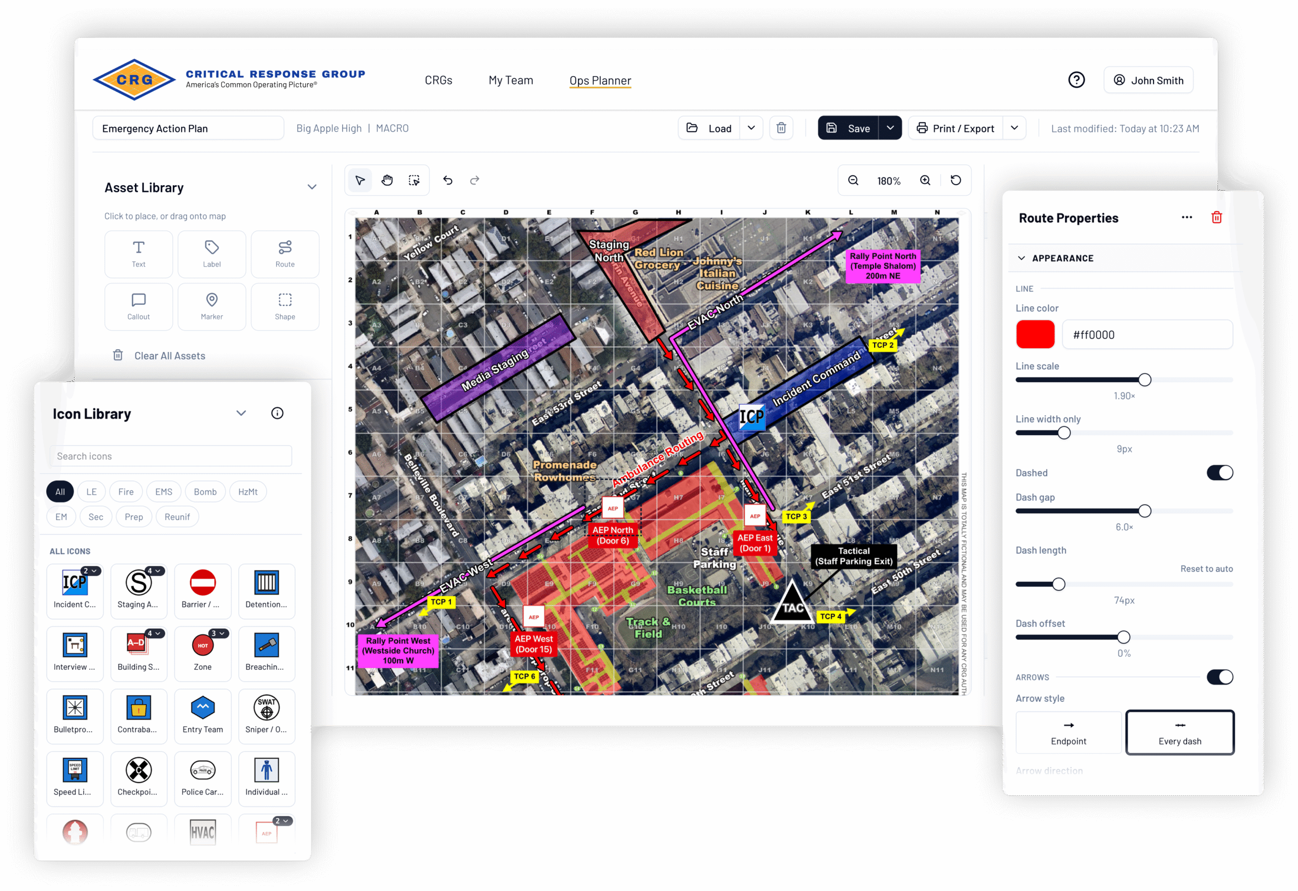
Build emergency action plans, special event operations and other pre-incident plans directly on your Collaborative Response Graphics®. CRG Ops Planner extends your field-verified CRGs into the planning process, giving public safety agencies a shared geographic foundation for coordinating operations before response begins.
Available at no cost to public safety agencies wherever CRGs have been deployed.
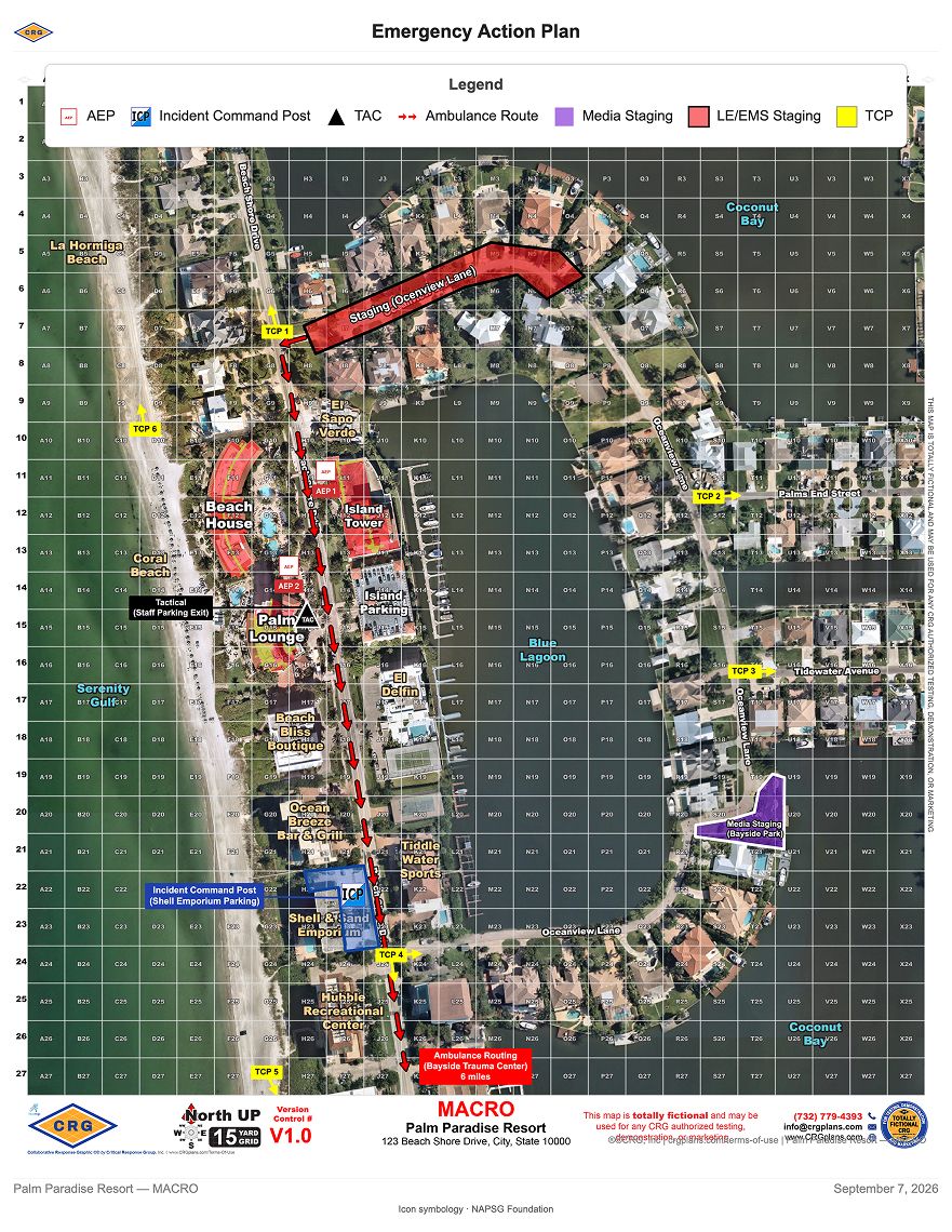
Preparedness and response shouldn’t happen on different maps.
Public safety operations begin long before the first unit responds.
Agencies establish command locations, determine where resources will stage, coordinate access and traffic control, identify emergency routes and make dozens of other operational decisions before an event or incident begins. But too often, those plans are developed separately from the maps and systems responders will rely on when it’s time to act.
CRG Ops Planner brings planning and response together around one common operating picture.
Police, fire, EMS, 911, SWAT and emergency management teams can build plans directly on their CRGs—giving participating agencies and disciplines a common geographic reference from preparedness through response.
Bring every element of the operation into view.
CRG Ops Planner gives agencies the flexibility to map the elements that matter to their mission.
Command & Coordination
Establish incident command posts, operational zones, sectors and perimeters to clearly communicate how an operation will be organized.
Resources & Response
Identify staging areas, casualty collection points, triage locations, reunification sites and other critical resources.
Access & Movement
Plan emergency and evacuation routes, establish access points and designate traffic control locations.
Your Operational Needs
Add agency-defined resources and information based on the event, incident, facility or mission.
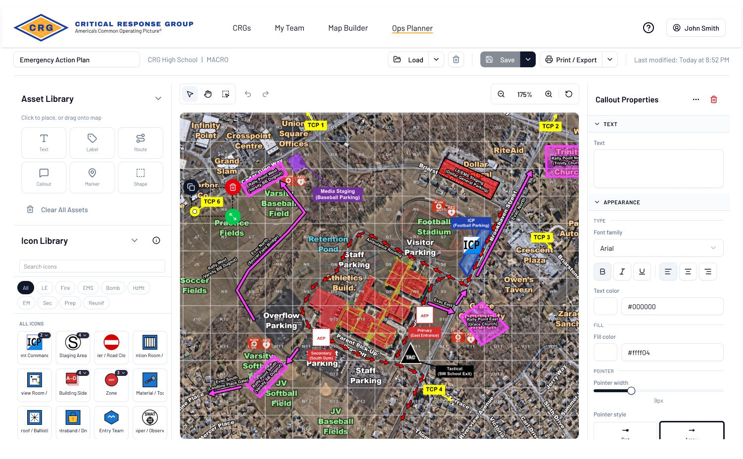
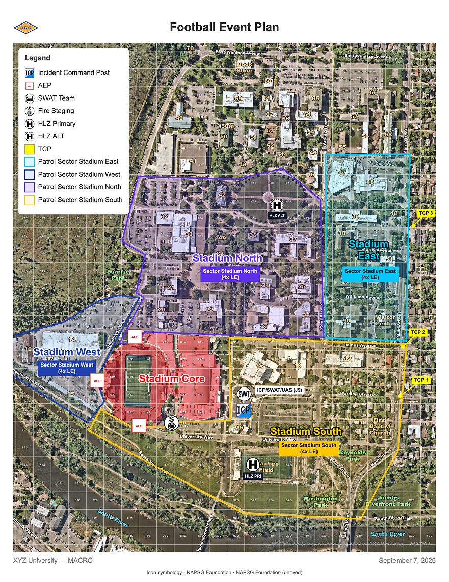
Built for the full range of public safety operations.
From a single-facility emergency action plan to a large, multi-agency event, CRG Ops Planner supports planning across a wide range of missions.
Emergency Action Planning
Develop site-specific plans around a field-verified map built specifically for emergency response.
Special Events & Large Gatherings
Plan command, staging, security, traffic, access, emergency routes and other requirements for planned events.
Complex Incident Preparedness
Prepare for active-threat, mass-casualty and other complex incidents where coordination across responding disciplines is critical.
Multi-Agency Operations
Give participating agencies and jurisdictions a common geographic reference for mutual-aid and coordinated operations.
The tools to plan clearly and move quickly.
Turn operational decisions into a clear visual plan with intuitive tools, familiar public safety symbology and the flexibility to adapt as the plan evolves.
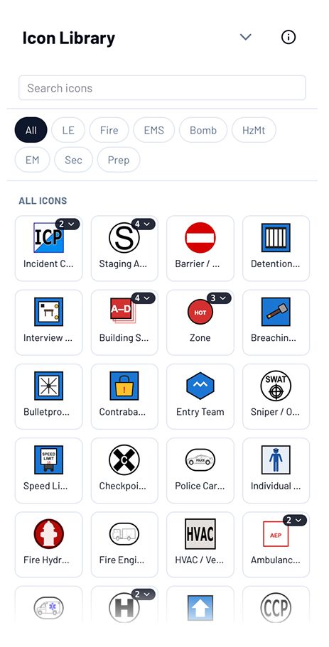
Public Safety Symbols, Ready to Use
Choose from prebuilt NAPSG public safety icons to quickly identify command, staging, medical, access, traffic control and other operational elements.
Drag, Drop and Adjust
Place elements directly on your CRGs, move them where you need them and make updates as the plan develops.
Map the Details That Matter
Create routes, define operational areas, add labels and incorporate agency-specific resources based on the needs of your event, facility or operation.
Plans Change. Your Map Can Too.
Quickly update locations, routes, resources and other elements as conditions, assignments and requirements evolve.
Your common operating picture is already in place. Start planning from it.
Communities across the country have invested in building and field-verifying CRGs to give responders a shared understanding of the environment when it matters most.
CRG Ops Planner puts that investment to work earlier—extending the same common operating picture into preparedness and planning.
One common operating picture.
From preparedness through response.
CRG Ops Planner is available now at no cost to public safety agencies wherever CRGs have been deployed.