PLEASE NOTE: NAVIGATION AWAY FROM THIS PAGE DOES NOT REPRESENT TEXAS DIR CONTRACT OFFERINGS

Products and Services Available Under the DIR Contract
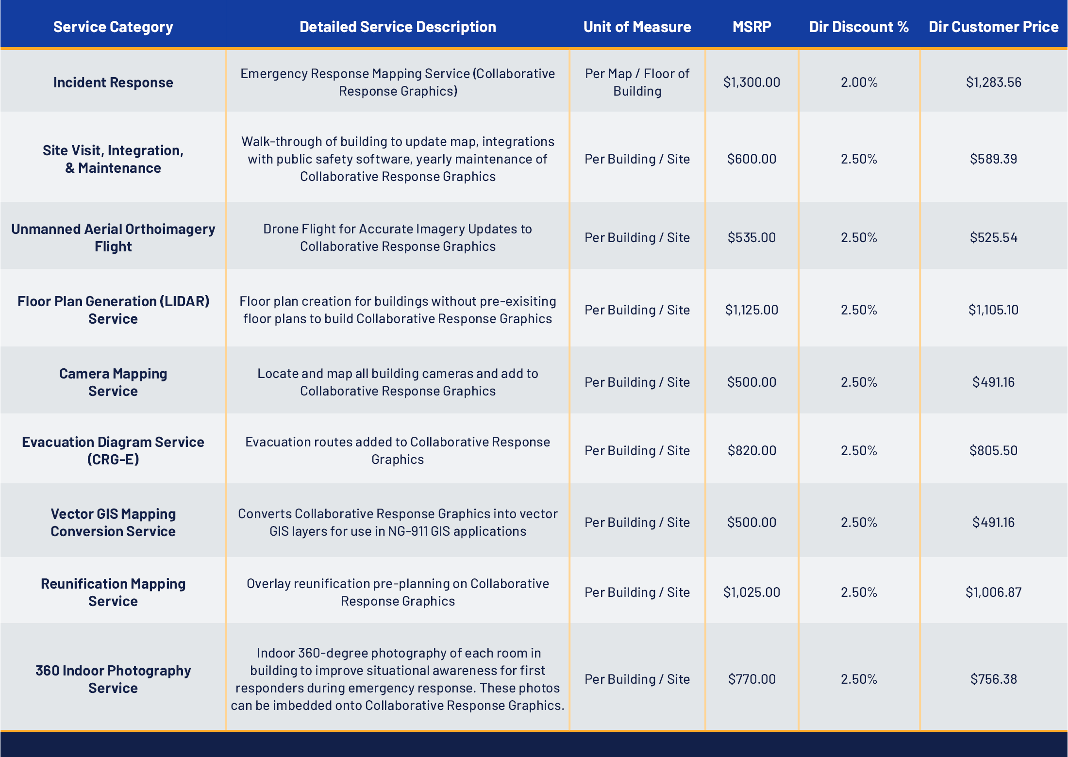
Collaborative Response Graphics® (CRGs)
Field-verified mapping data delivered in universally compatible formats for immediate use by schools, public safety agencies, and emergency management partners that include drone aerial photography, floor plans, and other data.
Additional Emergency Mapping and Planning Services
A dedicated CRG project team oversees scheduling, walkthroughs, data collection, proofing, and delivery to ensure accurate, high-quality outcomes. Integration into 100+ technology systems, including CAD, GIS, camera management, panic button, and real-time tracking solutions — many of which are already used by DIR-eligible entities.
Site Visit, Integration, and Maintenance
Virtual training sessions, user guides, quick-reference materials, and tabletops ensure stakeholders can confidently access and apply CRGs during critical incidents.
Training and Implementation Resources
Security camera placement and mapping services, evacuation route planning, data conversions for NextGeneration 911 use, reunification planning and mapping, 360 degree indoor photography integrated with emergency response mapping.
Instructions for Obtaining Quotes
Download PDAA Spreadsheet
Warranty:
For the period of (1) year post delivery of emergency response mapping data, CRG will replace incorrect map files or regenerate outputs at no cost. This includes completing additional site visits and additional implementation meetings as required to ensure accuracy and integration of maps. There are no fees for file format conversions or re-distribution during the warranty period. CRG will maintain a documented change log for all corrections to be made available upon request, as every CRG map “version” is saved.
Returns:
Not applicable

Lee Culpepper
Regional Director of
Sales and Implementation
910-459-0128
lculpepper@crgplans.com