This article originally appeared on Global Newswire. To view the original article, click here.
Wisconsin Leads Eleven States to Pass Common Sense Laws or Initiatives Enabling Swift and Effective Emergency Response; Multiple Other States Are in Progress
Critical Response Group (CRG), the nation’s leader in critical incident mapping data, today announced a successful bipartisan legislative effort that has resulted in the unanimous passing of critical incident mapping laws or state-level initiatives for schools in Wisconsin, Delaware, Florida, Illinois, Michigan, New Jersey, Texas, Kentucky, Nebraska, Maryland, and Virginia, with many other state bills in progress.
Bipartisan legislative outcomes are rare in today’s political environment, so this unanimous support underscores the importance and urgency of enhancing emergency response efforts with critical incident mapping. Wisconsin was the first state to lead the way with successful bipartisan efforts that served as a model for further legislation, leading to the unanimous passing of critical incident mapping laws in multiple states.
“The Wisconsin Chiefs of Police Association brought CRG’s work to my attention, and I immediately realized the value for a true statewide standard for critical incident mapping,” said State Senator Van Wanggaard. “This is common sense legislation: when first responders are racing against time to save lives, they cannot waste precious minutes trying to make sense out of an inaccurate map. When the police and fire departments are working off of different maps due to incompatible software, it could put people at risk. CRG has worked from the ground up to create best practices for critical incident mapping, and the legislation that I and my colleague State Assemblyman (now Senator) Jesse James drafted for Wisconsin follows suit.”
Founded by US military special operations veterans, Critical Response Group adapted and domesticated the military’s gridded reference graphics (GRG) technique to create accurate and detailed maps tailored for emergency responders.
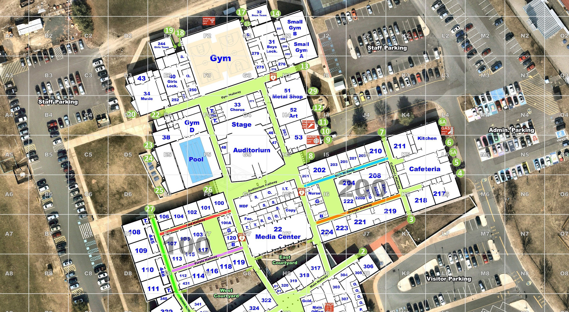
Critical incident mapping involves combining high-resolution aerial imagery with on-site verified floor plans, site-specific labels, and an alphanumeric grid overlay. The final product provides an accurate and up-to-date common operating picture that first responders from different agencies can use to communicate and coordinate with each other during an emergency response. CRG’s mapping data is made available within the existing software platforms used across public safety including 911 centers, CAD platforms and mobile applications.
“We took a mapping technique that was perfected through thousands of repetitions and lessons learned overseas, and worked with law enforcement experts and practitioners to develop a domestic solution that would address the well-documented challenges unique to public safety responses,” said CRG co-founder and CEO Mike Rodgers. “As stakeholders and leadership organizations have become increasingly aware of the effectiveness of our mapping technique, it has become recognized as a protective measures best practice. This ever-growing groundswell of support has put our solution on the radar of legislators who are eager to solve a problem that has plagued emergency response efforts across the county.”
With over 14,000 schools mapped by CRG and growing legislative support for critical mapping laws from legislators, efforts to enhance first responders’ capabilities during critical incidents are rapidly advancing nationwide.

