CRG maps are integrated into OPS Schools & Structures™ , OPS Community Cameras™ , IMS|HUB™ and NPS-AID™ mapping, allowing responders to view site grids, room labels, access points, critical infrastructure, cameras, ALPRs, and other mission-critical OPS assets together on a single map.
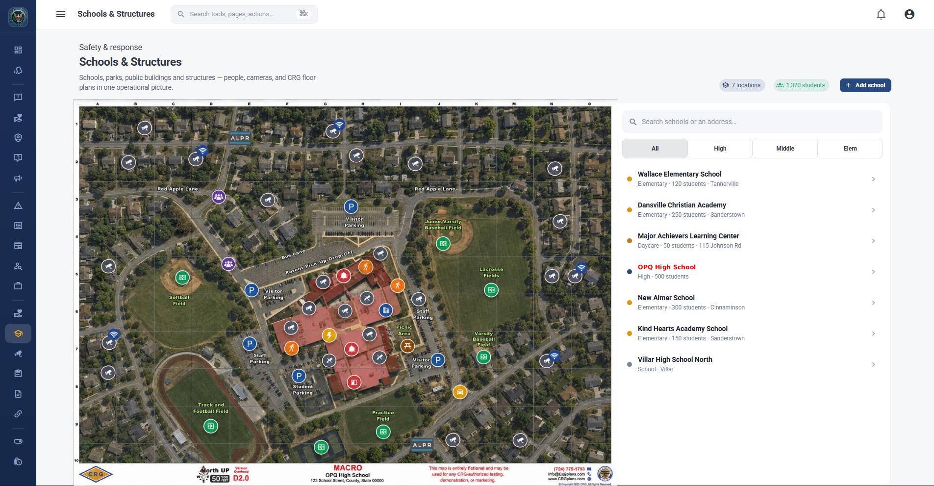

The OPS Network™ integrates Critical Response Group (CRG) Collaborative Response Graphics® directly into its mapping environment, creating a unified operational picture for agencies and responders.
- One Common Operating Picture: CRG maps, cameras, ALPRs, and OPS mapping icons are layered together in one shared operational view.
- Schools & Critical Structures: Detailed campus and facility graphics provide room numbers, entrances, exits, halls, shutoffs, exterior grids, and other critical response information.
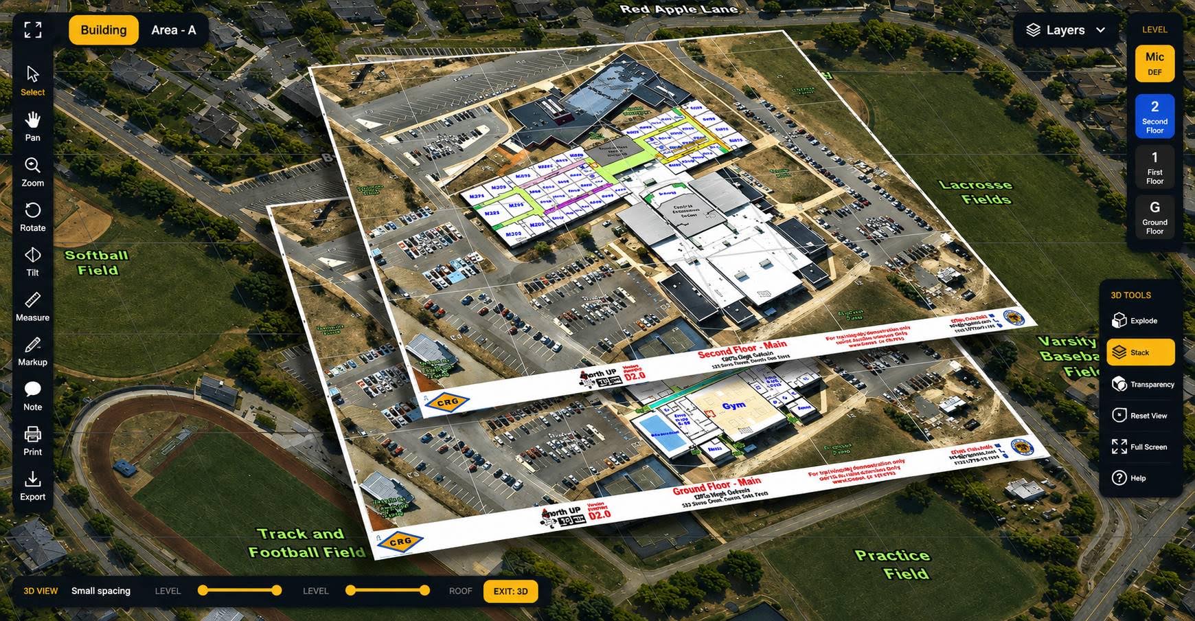
- 3D & Micro Floor Overlays: Responders can navigate detailed floor levels and facility information without leaving the primary operational map.
- Integrated Camera Mapping: Community and government cameras can be displayed directly against the CRG geographic framework.
- HUB & Operational Mapping: IMS|hub™ and other OPS workflows can leverage the same CRG mapping foundation for investigations, events, and multi-agency operations.
- NPS-AID: Map integration providing the power of OPS and CRG when looking for endangered or missing persons.
The result is one map, one operational picture, and a shared location language across agencies—reducing the need to switch between separate mapping systems and helping command staff, field personnel, and partner agencies coordinate more effectively when seconds matter.