Choosing a school safety mapping vendor is more than a technology decision. It is a public safety decision that affects how quickly school leaders and first responders can understand a location and coordinate during an emergency.
As more states establish school safety mapping requirements and make grant funding available for critical incident mapping, districts need to look beyond whether a vendor can simply produce a floor plan. The stronger question is whether the final mapping data is accurate, responder-ready, GIS-enabled, interoperable and usable in the systems public safety agencies already rely on.
Critical Response Group (CRG) has produced more than 100,000 responder-ready maps nationwide. Its Collaborative Response Graphics® (CRGs®) are built through on-site validation and designed specifically for emergency response. CRG has mapped more than 30,000 K–12 schools across 46 states and supports thousands of public safety agencies through an ecosystem of more than 200 technology and operational partners.
Before selecting a school safety mapping provider, districts should ask these eight questions.
1. Are the maps designed specifically for public safety operations?
Why it matters: A school map can serve many purposes, from facilities management to wayfinding. But an emergency response map should be designed first for the people who will need to use it under pressure.
What to look for: Look for a mapping process that incorporates direct public safety input and presents the information responders need in a clear, standardized format. The map should help police, fire, EMS, 911 and school personnel establish a common operating picture quickly – without requiring them to interpret a facility’s blueprints or learn a new visual language.
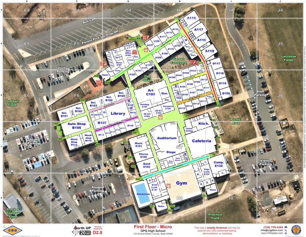
How CRG approaches it: CRG’s Collaborative Response Graphics® are purpose-built for emergency response. Developed from techniques used by U.S. Special Operations personnel and refined with public safety professionals, CRGs combine verified floor plans, critical landmarks and features, aerial imagery and a gridded overlay into a standardized format designed for high-stress incidents.
2. Are the maps GIS-enabled and delivered in formats first responders actually use?
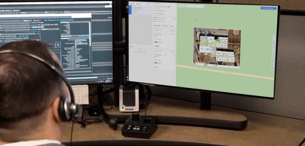
Why it matters: A map is only useful during an emergency if responders can access it where they already work. Requiring agencies to log into a separate proprietary platform can create an unnecessary barrier at the exact moment speed matters most.
What to look for: Ask whether the mapping data is GIS-enabled, georeferenced and available in interoperable file formats that can be incorporated into 911, CAD, GIS, emergency management and other public safety systems.
How CRG approaches it: CRG is data-centric and system-agnostic. Its mapping data is designed to integrate into the platforms agencies already use, helping districts and public safety partners avoid creating another isolated system or login.
3. Does the vendor integrate with existing systems – and who manages that process?
Why it matters: Saying a map “can integrate” is not the same as ensuring it is actually implemented where responders need it.
What to look for: Districts should ask vendors to explain the implementation process: Which systems will receive the mapping data? Who works with local agencies and technology providers? What formats are required? How is successful deployment verified?
How CRG approaches it: CRG’s implementation team works directly with local law enforcement, fire, EMS, dispatch, emergency management and technology partners to determine where the maps need to live and how they should be delivered. CRG’s broader ecosystem now includes more than 200 technology and operational partners.
4. How are the maps field-verified – and who conducts the walkthrough?
Why it matters: Accurate emergency mapping requires more than importing an existing floor plan. Buildings change, room names evolve, entrances are reconfigured and legacy drawings may not reflect current conditions.
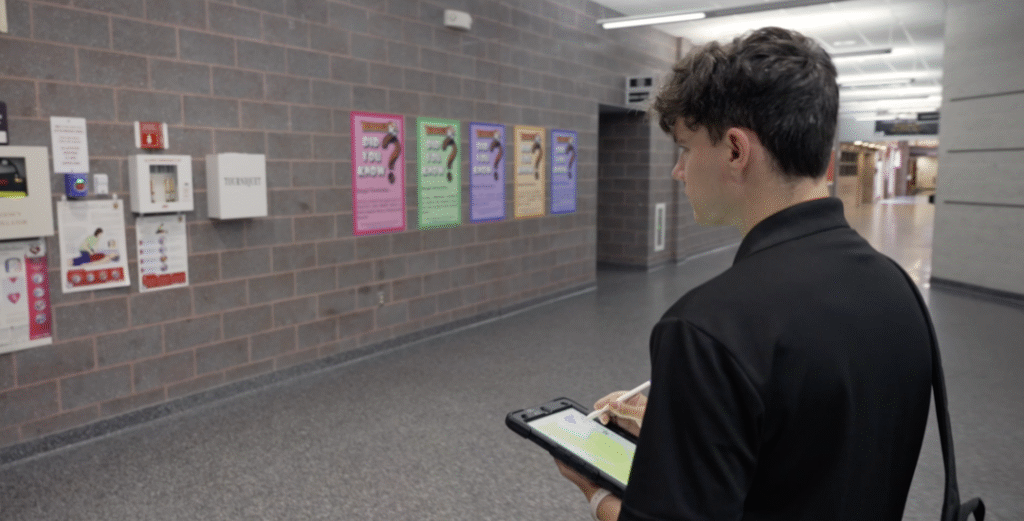
What to look for: Ask whether trained mapping personnel physically walk each location and verify the details that matter to responders, including access points, room labels, critical infrastructure, safety features and other site-specific information.
How CRG approaches it: CRG conducts on-site validation as part of its mapping process. Trained specialists review each facility and standardize critical information so that the resulting map reflects the actual environment responders may encounter.
5. Who is responsible for maintaining and updating the maps?
Why it matters: School campuses change. Portable classrooms are added, spaces are renovated, access points move and building uses evolve. A mapping program should include a clear process for keeping critical information current.
What to look for: Districts should understand who is responsible for edits, what triggers an update, how quickly changes can be made and whether updates maintain the same public safety standards as the original map.
How CRG approaches it: CRG manages map updates through its team rather than shifting mapping responsibility onto school personnel. This helps preserve consistency and standardization as facilities change over time.
6. Who owns the mapping data, and where can it be used?
Why it matters: Districts should understand whether their maps remain usable outside a vendor’s proprietary application. Data that is locked inside a single platform can limit how easily it is shared with public safety partners or incorporated into future technology.
What to look for: Ask who owns the completed mapping data, what file formats are provided, whether there are restrictions on sharing or integration, and whether the maps remain accessible in those system if your mapping software subscription ends.
How CRG approaches it: CRG delivers interoperable mapping data designed for use across systems and agencies. The goal is to make the same trusted geographic reference available wherever school leaders and public safety partners need it.
7. What does the solution really cost – upfront and over time?
Why it matters: The initial mapping proposal may represent only part of the total cost. Some solutions add recurring software licenses, user fees, integration charges or subscription requirements that can affect long-term access.
What to look for: Districts should ask for the full lifecycle cost: mapping, field verification, implementation, integrations, software licenses, user fees, updates and ongoing maintenance.
How CRG approaches it: CRG’s core mapping model is designed around the mapping data itself rather than requiring districts or agencies to purchase a separate proprietary response platform simply to access the maps. CRG offers a straightforward pricing model. There is a one-time cost for development and implementation, which includes walkthroughs, mapping, formatting, and delivery and implementation in all the required formats. There are no hidden fees or required software licenses.
CRG also offers an optional annual implementation and maintenance service — a flat-rate fee that covers mapping updates, reformatting for new platforms, and continued integration support as your systems or partners evolve. It’s a fraction of the cost of typical subscription-based models and ensures your maps stay up to date and fully operational year after year.
8. Does the mapping solution meet current state requirements – and is it prepared for future ones?
Why it matters: School safety mapping requirements continue to expand across the country, and some state programs connect mapping standards directly to grant eligibility or statewide public safety initiatives.
What to look for: Districts should verify that a provider understands any applicable state specifications, required data formats, field-verification requirements, public safety integrations and submission standards. Even where no statewide requirement exists, choosing a responder-focused and interoperable standard can help a district prepare for future requirements.
How CRG approaches it: CRG has supported school mapping efforts across 50 states, including large district and statewide initiatives, and has extensive experience delivering field-validated, GIS-enabled mapping data for K–12 environments.
Frequently Asked Questions About School Safety Mapping
What is school safety mapping?
School safety mapping is the creation of accurate, location-specific mapping data designed to help schools and public safety agencies communicate, navigate and coordinate during emergencies. Strong programs typically combine verified building information with GIS-enabled location data and responder-focused symbology.
What should an emergency response map include?
The exact requirements vary by jurisdiction, but useful emergency response maps generally include verified floor plans, room and area labels, entrances and access points, critical safety features, exterior landmarks and a standardized geographic reference that responders can communicate from.
Why does GIS matter for school emergency maps?
GIS-enabled mapping data can be positioned accurately within a geographic environment and incorporated into the CAD, 911, GIS and response systems agencies already use. This improves interoperability and reduces reliance on standalone files or applications.
Who should verify school emergency maps?
Verification should involve trained personnel who understand both the physical facility and the operational needs of police, fire, EMS and 911. Field validation helps ensure that the map reflects current conditions rather than relying solely on legacy floor plans.
Choosing a Mapping Partner That Works for Responders
Selecting a school safety mapping partner is ultimately about ensuring the people responding to an emergency have accurate, consistent information when they need it most. The right solution should be field-verified, interoperable, accessible across public safety systems and designed around real-world response – not simply around the creation of a digital floor plan.
CRG’s Collaborative Response Graphics® are built to create that shared operating picture across schools, dispatch centers and responding agencies. With more than 100,000 responder-ready maps produced nationwide, CRG combines field validation, GIS-enabled data and broad technology interoperability to help communities prepare before an incident and coordinate when seconds matter.
Interested in Learning More?
Talk with CRG about your district’s school safety mapping requirements, funding options and public safety integration needs.