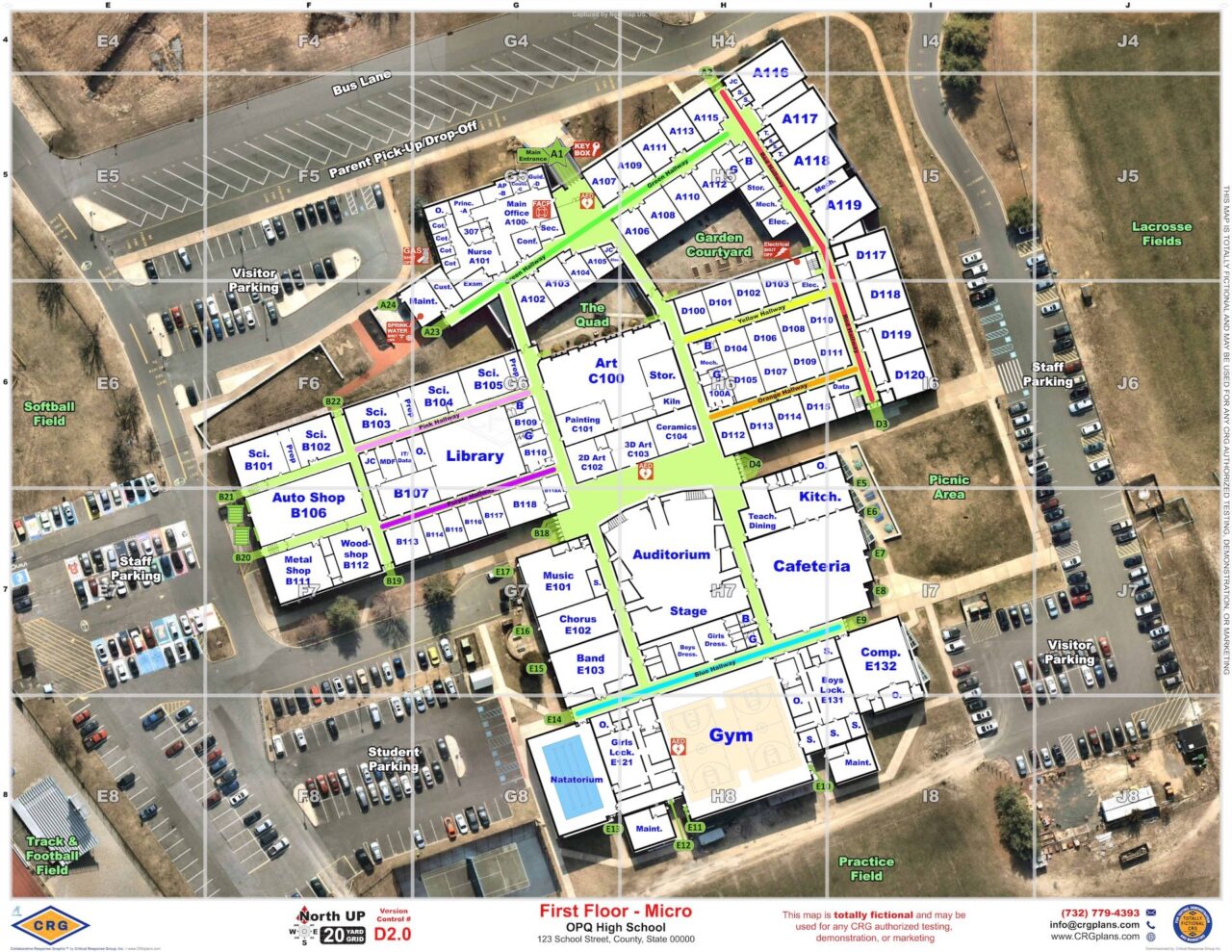
Critical Response Group provides field-validated critical incident mapping for K–12 schools and school districts, giving school personnel, 911 centers and first responders a shared operating picture of school buildings and campuses. Collaborative Response Graphics® combine floor plans, current imagery, site-specific information and a standardized grid into clear, usable maps designed to support communication and coordination during an emergency.
School Mapping Experience at Scale
30,000
Schools, Colleges, and Universities Mapped Nationwide
100,000
CRGs Created Nationwide
200
Public Safety and GIS Software Platforms Supported
Trusted by School Districts Across the Country






Give School Teams and First Responders the Same Operating Picture
During a school emergency, administrators, security personnel, 911, law enforcement, fire and EMS may all need to communicate about the same location. That becomes difficult when floor plans are outdated, room names have changed or different groups use different terminology for the same place. CRG gives schools and responders a consistent geographic reference. Each school is mapped using a standardized visual format, while site-specific terminology and critical features are verified in person. For districts with multiple schools, that same standard can be carried across elementary schools, middle schools, high schools and other facilities. Responders can work from a familiar format regardless of which campus they are called to.
What Is Included in a School Critical Incident Map?
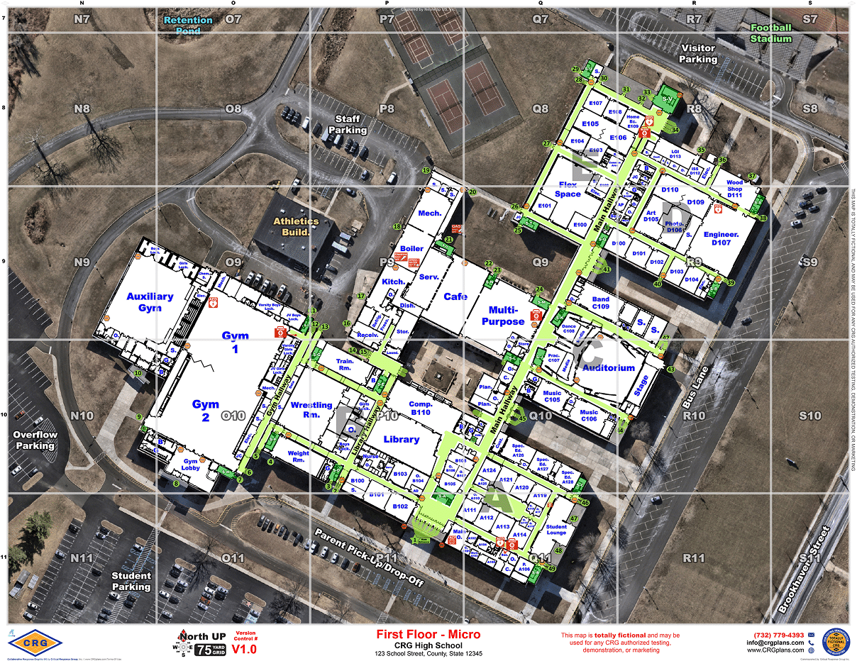
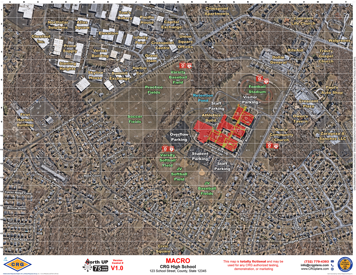
CRG maps provide both detailed building information and the surrounding campus context responders may need during an incident.
Available Where Schools and Responders Already Work
CRG mapping data is designed to work within technology already used by school districts and public safety agencies. CRG supports more than 200 public safety and GIS software platforms and works with each school district to identify the agencies most likely to respond to an emergency. Mapping data can then be delivered in formats compatible with their operational systems. Current CRG integrations include platforms such as Raptor Technologies, Navigate360, CrisisGo, RapidSOS, RapidDeploy, Motorola Solutions, Tyler Technologies, Esri, Genetec, Avigilon, Milestone and others. The result is consistent mapping data that can be available to school personnel, dispatchers and responders without requiring them to abandon the systems they already use.

Put Verified Mapping Data to Work Across the District
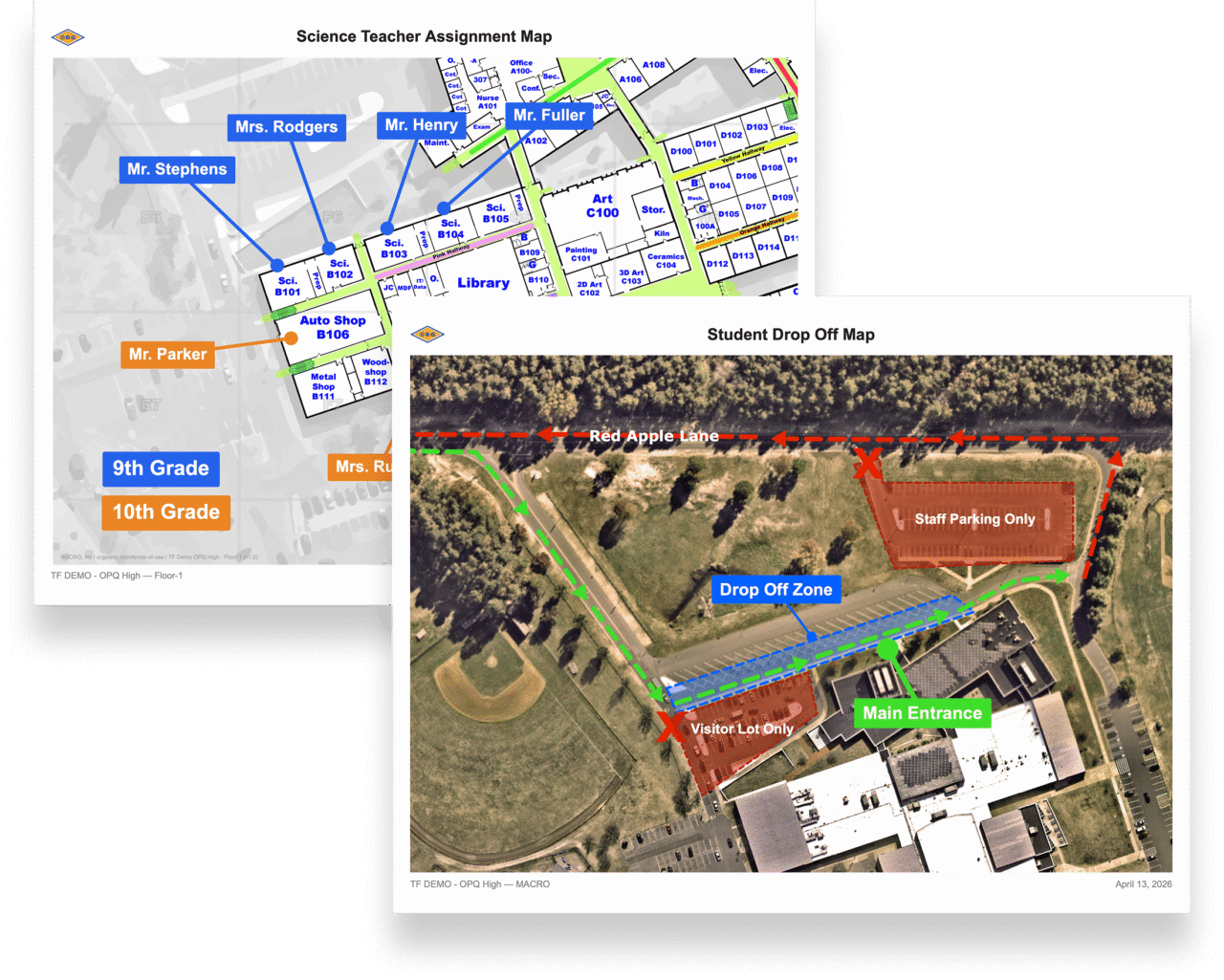
The same verified facility information used for emergency response can support additional planning and operational needs. Districts can use mapping data for evacuation and reunification planning, arrival and dismissal, parent pickup, graduation, athletics, emergency drills, construction, facilities projects and visitor navigation. CRG’s mapping tools also allow schools to create customized maps for internal needs using the same underlying facility data.
Support Beyond Initial Mapping
CRG continues to support districts even after the initial mapping project is complete.

Implementation & Maintenance
Keep mapping information current as facilities, campuses and public safety technology change.

Tabletop Exercises
Bring school leadership and public safety partners together to work through realistic emergency scenarios using the same maps that would support an actual response.

Map Builder
Use verified mapping data to create customized maps for evacuation, events, facilities and other district planning needs.
”CRGs allow school officials to communicate easily with first responders during an emergency. A key feature of the product is that we were able to integrate it into our existing emergency platforms without the need for additional purchases.
-School District in Virginia
Build a More Complete Picture of Your Schools
Give school personnel, 911 and first responders accurate mapping data they can use to communicate from the same operating picture. Speak with a CRG expert about critical incident mapping for your schools or district.
Frequently Asked Questions
What is critical incident mapping for schools?
Critical incident mapping gives school personnel and first responders a standardized view of a school building and surrounding campus for emergency planning and response. CRG’s Collaborative Response Graphics® combine floor plans, current imagery, site-specific information and a standardized reference grid into a shared operating picture.
How is a critical incident map different from a school floor plan?
A floor plan shows the physical layout of a building. A critical incident map adds operational information responders may need, including room labels, doors, access points, utilities, emergency equipment and campus features. CRG also verifies each site in person so the indoor map reflects current conditions.
What information can be included on a school emergency response map?
Depending on the school and district requirements, indoor mapping can include classrooms, room numbers, offices, hallways, exterior doors, stairwells, utilities, emergency equipment, security cameras and other critical locations. Exterior mapping can also include parking areas, athletic fields, roads, gates, access routes, staging areas and surrounding properties.
Can CRG map an entire school district?
Yes. CRG supports individual schools, multi-school districts, regional programs and statewide school mapping initiatives. Using the same mapping standard across a district gives responders a consistent format from one campus to another.
How do first responders access CRG maps?
CRG mapping data can be integrated into many of the CAD, GIS, 911, situational awareness, school safety and emergency management systems already used by school districts and public safety agencies. Authorized users can also access mapping data through the CRG Mapping Portal.
How are school maps updated when facilities change?
CRG supports updates for changes such as renovations, new wings, portable classrooms, security equipment, access points, parking areas and other building or campus modifications. Updated maps can then be reviewed, approved and redistributed to authorized school and public safety users.